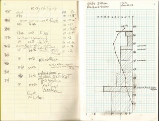
I am taking a Snow and Avalanche Studies class this semester through the UofU. I will be posting my data here each week as I get it. Some of these will be posted with TR's as we will do some tours to get to the areas where we will be taking the data. I will count these as separate days even though I will most likely have already gone on Friday morning for a tour. I just don't want things to get confusing.
Data: The snowpack is considerable shallow. It is very stable right now, so the observations are not that exciting. There is one "weak" layer about 24-30cm from the ground, but it took quite a lot to get it to fail. It is going to take a big storm to get into some dangerous conditions in the Wasatch.
PS. The poor handwriting on the left was not mine.

No comments:
Post a Comment